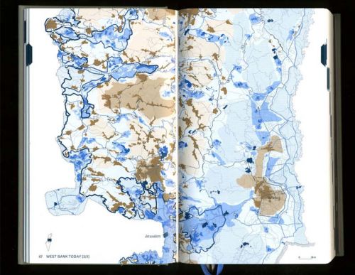
Now on sale, the Atlas of the Conflict represents the most comprehensive effort yet to offer a spatial mapping of the contemporary geography of Israel-Palestine and the history of its shaping. Architect Malkit Shoshan (Foundation for Achieving Seamless Territory) has produced a wide ranging and graphically rich publication likely to become an essential primer for anyone interested in understanding the fundamental spatial contours of the Israeli-Palestinian conflict and the possible shape of any future polity that might emerge.
 ATLAS CONTENTS
– Borders
– The Wall
– Pattern of settlements
– Settlement typologies
– Demography
– Land ownership
– Landscaping
– Water
– Archaeology and preservation
– Jerusalem

Description from the author:
The Atlas of the Conflict maps the processes and mechanisms behind the shaping of Israel-Palestine over the past 100 years. Over 500 maps and diagrams provide a detailed territorial analysis of the Israeli-Palestinian conflict, explored through themes such as borders, settlements, land ownership, archaeological and cultural heritage sites, control of natural resources, landscaping, wars and treaties. A lexicon, drawing on many different information sources, provides a commentary on the conflict from various perspectives. As a whole, the book offers insights not only into the specific situation of Israel-Palestine, but also into the phenomenon of spatial planning used as a political instrument.
(See also the author’s full introduction to the atlas and its conception.)


Images and text republished on arenaofspeculation.org with permission from the author. For more, take a look at the official website of the publication (www.atlasoftheconflict.org).
