A small selection of publications relating to the spatial conflict. Charting the mechanisms of occupation and offering alternative spatial narratives.
In Print
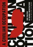 Civilian Occupation: The Politics of Israeli Architecture
Rafi Segal & Eyal Weizman (eds.), 2003
A lucid collection of articles, maps and photographs describing the spatial processes and politics of colonization in Israel and the occupied territories.
 Hollow Land: Israel’s Architecture of Occupation
Eyal Weizman, 2007
A detailed exploration of the ‘architecture’ of the Israeli occupation. Unravelling the mechanisms, processes and actors – political, military and civilian – involved in the transformation of the territory of Israel-Palestine since 1967.
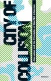 City of Collision: Jerusalem and the Principles of Conflict Urbanism
Philipp Misselwitz & Tim Rieneits (eds.), 2006
A collection of articles and mappings investigating the ever-evolving built environment of Jerusalem as both an arena and product of the wider Israeli-Palestinian conflict.
 Atlas of the Conflict
Malkit Shoshan, 2010
One of the most thorough graphical analyses of the conflict to date, with over 500 maps and diagrams charting the physical and demographic transformation of Israel-Palestine over the past 100 years.
 Subjective Atlas of Palestine
Annelys de Vet (ed.), 2007
An intimate, honest and very human portrait of contemporary Palestinian life, articulated through a collection of drawings, photographs, maps and narratives from Palestinian artists, photographers and designers.
 All That Remains: The Palestinian Villages Occupied and Depopulated by Israel in 1948
Walid Khalidi, 1992
A detailed survey of nearly 500 of the Palestinian towns and villages depopulated by Israel in 1948. Charting their history, and present condition in maps, photographs and written narrative.
 Sacred Landscape: The Buried History of the Holy Land
Meron Benvenisti, 2002
An account of the intimate relationship between archeology and contemporary political ideology in modern Israel, and the parallel processes of selectively constructing a Hebrew ‘Israeli’ historical narrative of the natural and built landscape whilst erasing an Arabic ‘Palestinian’ one.
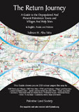 The Return Journey: A Guide to the Depopulated and Present Towns and Villages and Holy Sites
Salman Abu Sitta, 2008
A road atlas charting the present and absent Palestinian landscape of Israel-Palestine. Offering, in particular, a comprehensive guide to the remains of the towns and villages depopulated in 1948 and suggested routes for visiting them.
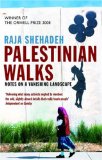 Palestinian Walks: Notes on a Vanishing Landscape
Raja Shehadeh, 2008
A personal account of the processes transforming the landscape of the West Bank, and the parallel brutality and absurdity of the Israeli occupation. Narrated through a series of hill walks taken by the author between the late 1970s and mid 2000s.
Online
 Resisting Spaciocide: Notes on the Spatial Struggle in Israel-Palestine
Ahmad Barclay, 2010
[Download PDF: low res (5mb), high res (22mb)]
An investigation into the present practices of ‘spatial resistance’ in Israel-Palestine, and their implications for the future of the spatial struggle.
 Advancing the Struggle for Urban Justice to the Assertion of Substantive Citizenship: Challenging Ethnocracy in Tel Aviv-Jaffa
Dena Qaddumi, 2011
[Download PDF]
Exploring the planning-citizenship relationship and transformative potentials in the urban context of Tel Aviv-Jaffa.
 Land Grab: Israel’s Settlement Policy in the West Bank
B’Tselem (Yehezkel Lein & Eyal Weizman), 2002
[Download PDF]
The first report to offer a comprehensive mapping of Israeli settlements and land annexations in the West Bank, their jurisdiction, expansion and planning. Still makes valuable and relevant reading nearly a decade later.
 The Prohibited Zone: Israeli Planning Policy in the Palestinian Villages in Area C
Bimkom, 2008
[Download PDF]
A detailed investigation of the Israeli planning restrictions facing Palestinians in Area C of the West Bank (around 60% of the territory), closely mirroring the situation in East Jerusalem.
 Under the Guise of Security: Routing the Separation Barrier to Enable Israeli Settlement Expansion in the West Bank
B’Tselem & Bimkom, 2005
[Download PDF]
A key report demonstrating graphically how land annexation around Israeli settlements over-rode security concerns in the routing of the West Bank barrier.
 The Planning Crisis in East Jerusalem: Understanding the phenomenon of “illegal” construction
UN-OCHA, 2009
[Download PDF]
Report by the UN Office for the Coordination of Humanitarian Affairs, offering an overview of how planning mechanisms and house demolitions are being used to constrict Palestinian development in occupied East Jerusalem.
 Survey of Palestinian Refugees and Displaced Persons
Badil Resource Center, 2009
[Chapters (PDF): Intro, 1, 2, 3, 4, 5]
A comprehensive guide to the Palestinian Diaspora, its history and its contemporary predicament; underlining the stateless and extra-territorial condition of the Palestinian people, and the centrality of the ‘refugee issue’ to the Palestinian cause.
 Decode Jerusalem: An Alternative Travel Guide
Brave New Alps, 2008
[Download PDF]
A invaluable guide to the spatio-political contours of East Jerusalem, offering readers a concise graphical overview of the sites on the fringes, behind the scenery of the touristic stageset.